Artificial intelligence is helping us understand our world more. This year, CREATE LAB’s new website, earthtime.org, uses AI to show us how Earth has been impacted by climate change.
On Earth Day this year, more than 1 billion people in 192 countries took part in the largest civic-focused day of action in the world. We’ve come a long way since the first Earth Day on April 20, 1970—almost 50 years ago. Not only are more people than ever taking personal action to help protect the Earth, but we also have tools that finally make it possible to see and make sense of the very real changes that are taking place today.
On Earth Day, the team at Carnegie Mellon’s CREATE Lab is put the power into the hands of anyone, anywhere using the magic of artificial intelligence, machine vision and graphics, and big data.
Announcing Earthtime.org
Beginning on Earth Day 2018, CREATE LAB’s new website, earthtime.org, enables users to steer through the space and time of the Earth to visually and viscerally understand change over the past hundred years and more. Using the GPU in each user’s computer and the most recent advances in browser control, the system applies billions of pixels of data gathered by NASA and aggregated at LANDSAT to enable a bird’s-eye view of how quickly and dramatically land surfaces are changing around the globe. The goal is to help individuals, governments, and corporations to gain new insights into some of the most important changes that are impacting the planet today.
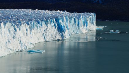
AI Shows Impact of Climate Change
For example:
- See the impact of deforestation: More than half of the world’s rainforests have been razed over the past 100 years. Atmospheric scientists agree that about 12% of all man-made climate emissions now comes from deforestation, mostly in tropical areas. This means that conserving the remaining forests is critical to combating climate change. Using images from every LANDSAT satellite, the system can illustrate just how quickly the rainforests are being depleted and where the most dramatic changes are taking place.
- See the world’s deserts expand: The Sahara Deserthas grown by about 10% due to changes in the climate over the past 8 decades, and recent research shows that human-caused climate change accounts for around a third of the increase. Using collected data points and images, the system can demonstrate the very real impact of desert expansion around the globe.
- See the ‘Sea of Plastic’ firsthand: This year’s Earth Day is dedicated to plastics pollution. One of the worst examples of this is the ‘Sea of Plastic’ in the Caribbean. And while the slideshow that made it famous is pretty dramatic in itself, earthtime.org will allow users to access historical satellite images to see firsthand how this massive collection of trash has grown in just the past 5 years.
The CREATE Lab has worked with the World Economic Forum for years to deliver this powerful visual information system to help us forge common ground on how the planet and our urban landscapes are changing. Using every LANDSAT satellite image, all manner of trade flows around the world, demographic and pandemic data, and some four hundred other layers of information, the system can be used to illustrate precisely how the world around us is changing every day.
Related: Artificial Intelligence in Banking
This is just one example of how AI and big data are being applied to the human condition. These tools make it possible to make sense of massive data available at the speed of light to help increase our ability to better understand how and why the Earth is changing, build consensus and, hopefully, chart a smart future together.
This article has been republished with permission from ROBO Global.